
Placerita Canyon
Introduction
Placerita Canyon may be the single most popular hiking destination in Santa Clarita, and for good reason. There’s something for everyone here - A complete nature center with live animals, historical sites, picnic areas, amphitheaters, a butterfly pond, and multiple hiking trails that are suitable for all ages and experience levels. Not to mention, here is where the first recorded discovery of gold in California took place!
Amenities
Nature Center
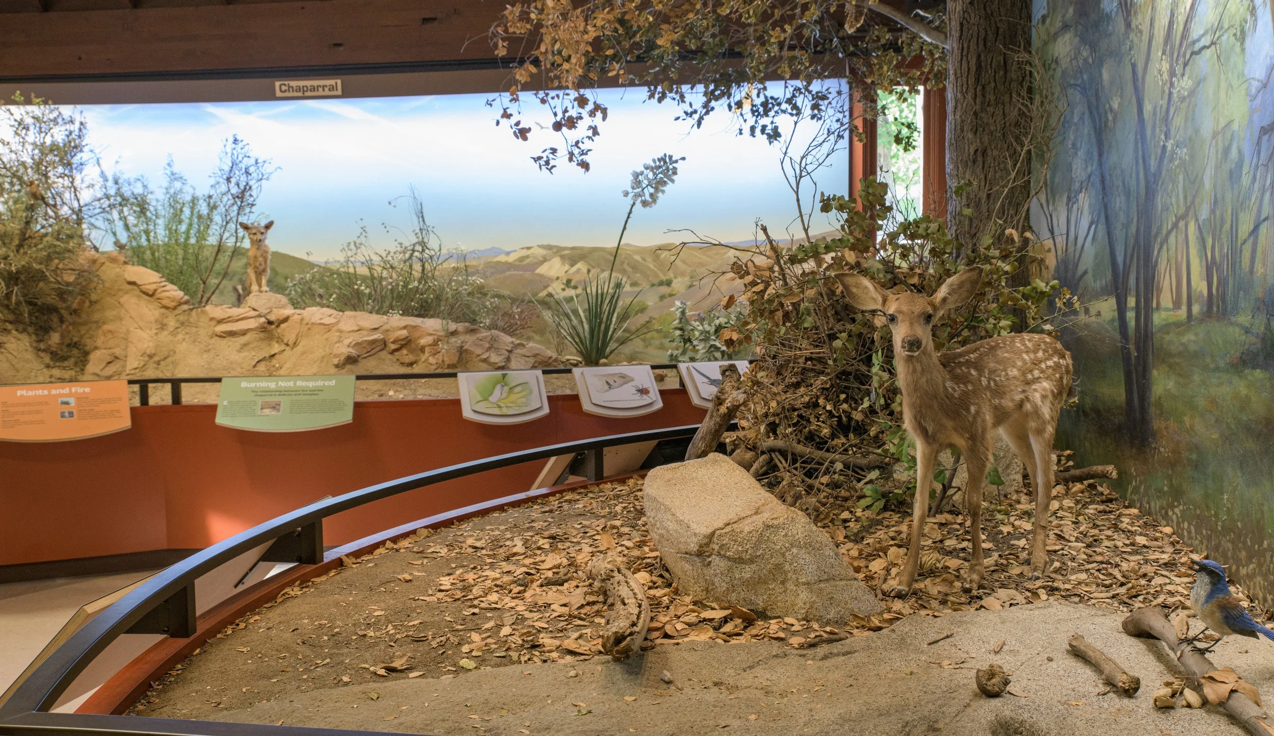
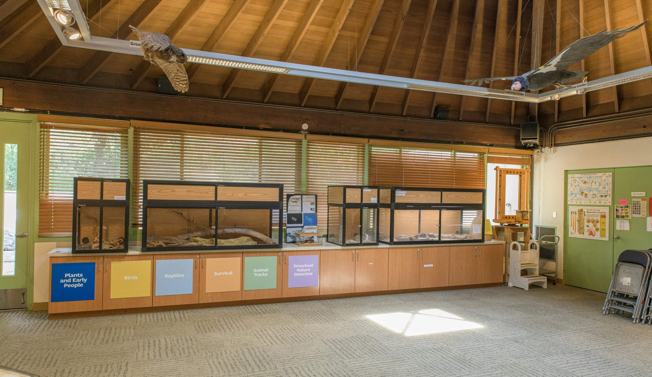
The first place to visit if you’re a newcomer here is the Placerita Canyon Nature Center. There are various exhibits and animals to see here as well as a gift shop. It’s a great place to orient yourself (there’s a scale model map of the park) and familiarize yourself with the park’s flora and fauna. On select days, the park’s staff also host educational classes and activities here.
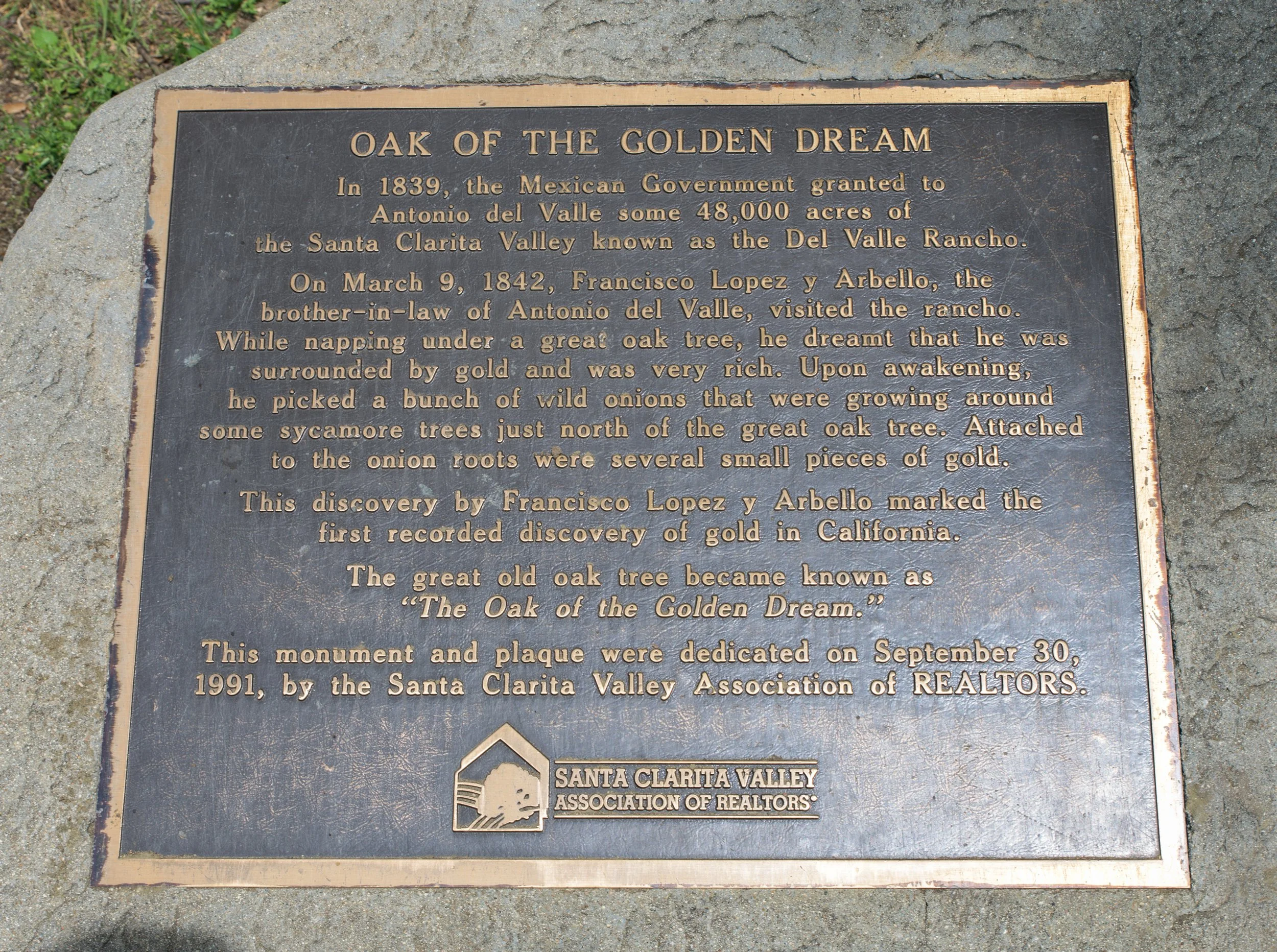
Oak of the golden dream
One surprising fun fact about Placerita is that it was the birthplace of the California gold rush. Under this oak tree was where Francisco Lopez y Arbello, in 1842, fell asleep and dreamt of being surrounded by gold, right before picking some onions and discovering small pieces of real gold attached to the onion roots. It was the first recorded discovery of gold in California.
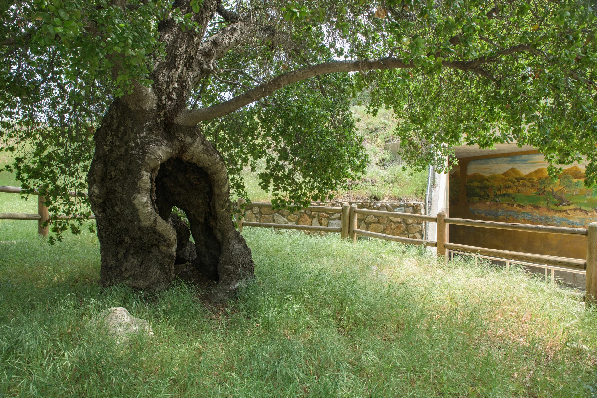
The tree is a short five-minute walk from the parking lot via the Heritage Trail (follow the signs) and is also wheel-chair accessible. There isn’t much to do at this spot other than see the tree and read about its history, but if you’re already at the park, and have never seen it, it’s worth the short stop.
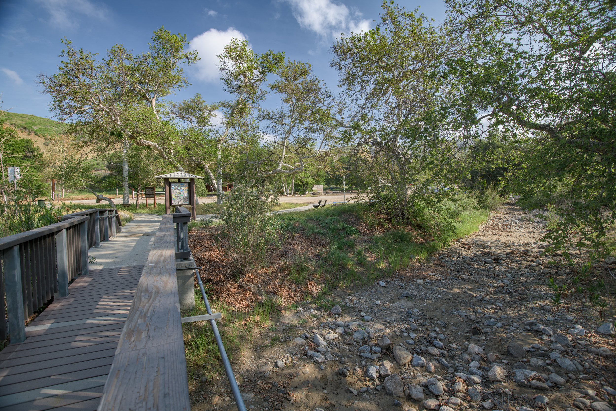
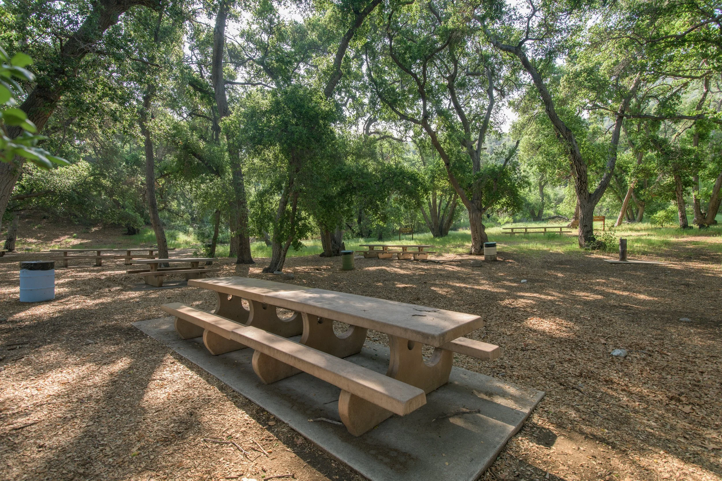
Picnic Tables / amphitheater
Another great perk of Placerita Canyon is how well-suited it is for group meetups, activities, and picnics. There are picnic tables, waste bins, and drinking fountains spread throughout the common areas of the park. On a day with good weather, there’s nothing like sitting under the oak trees listening to the birds and talking with friends.
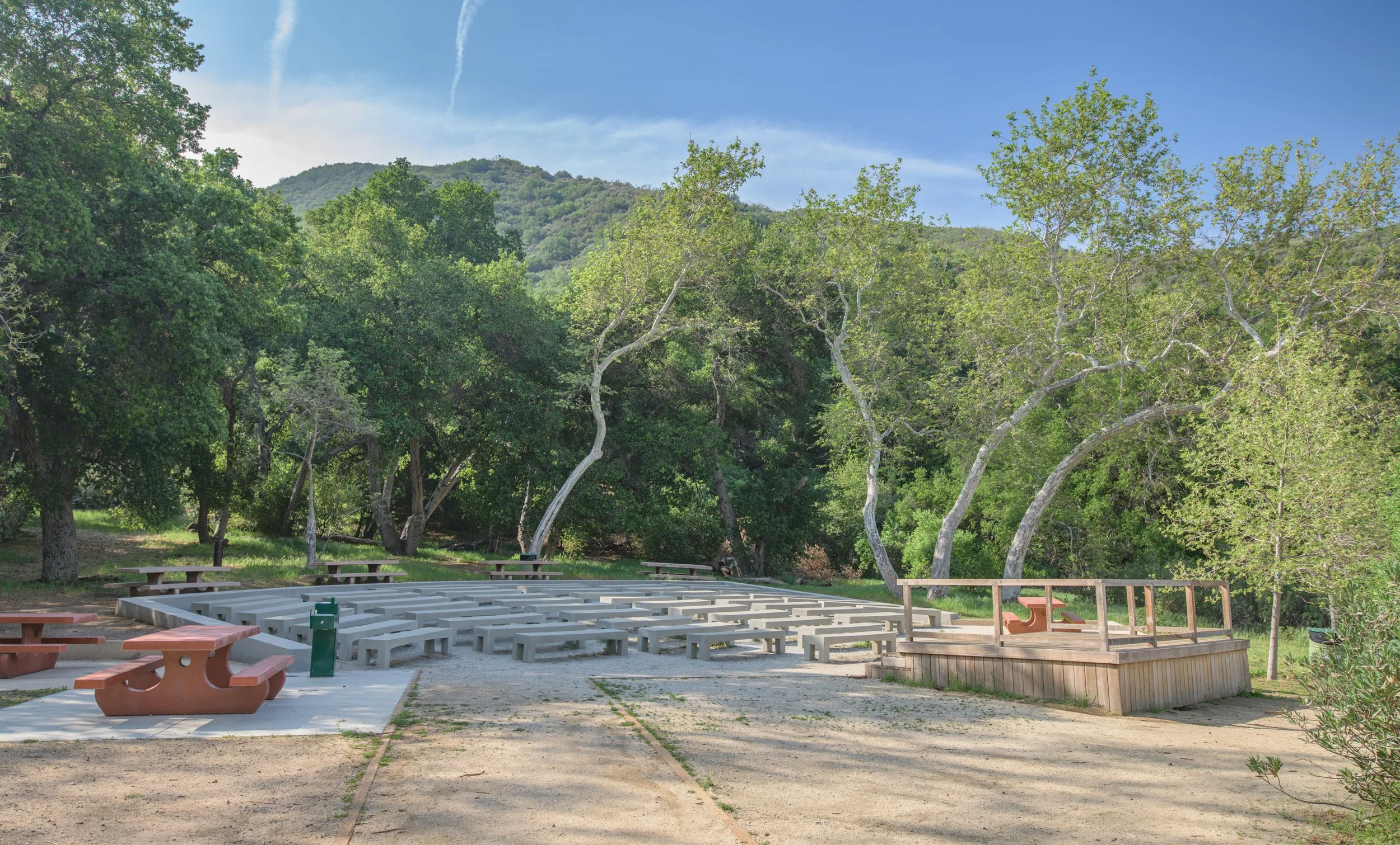
There is also an outdoor amphitheater that’s available for events.
trails
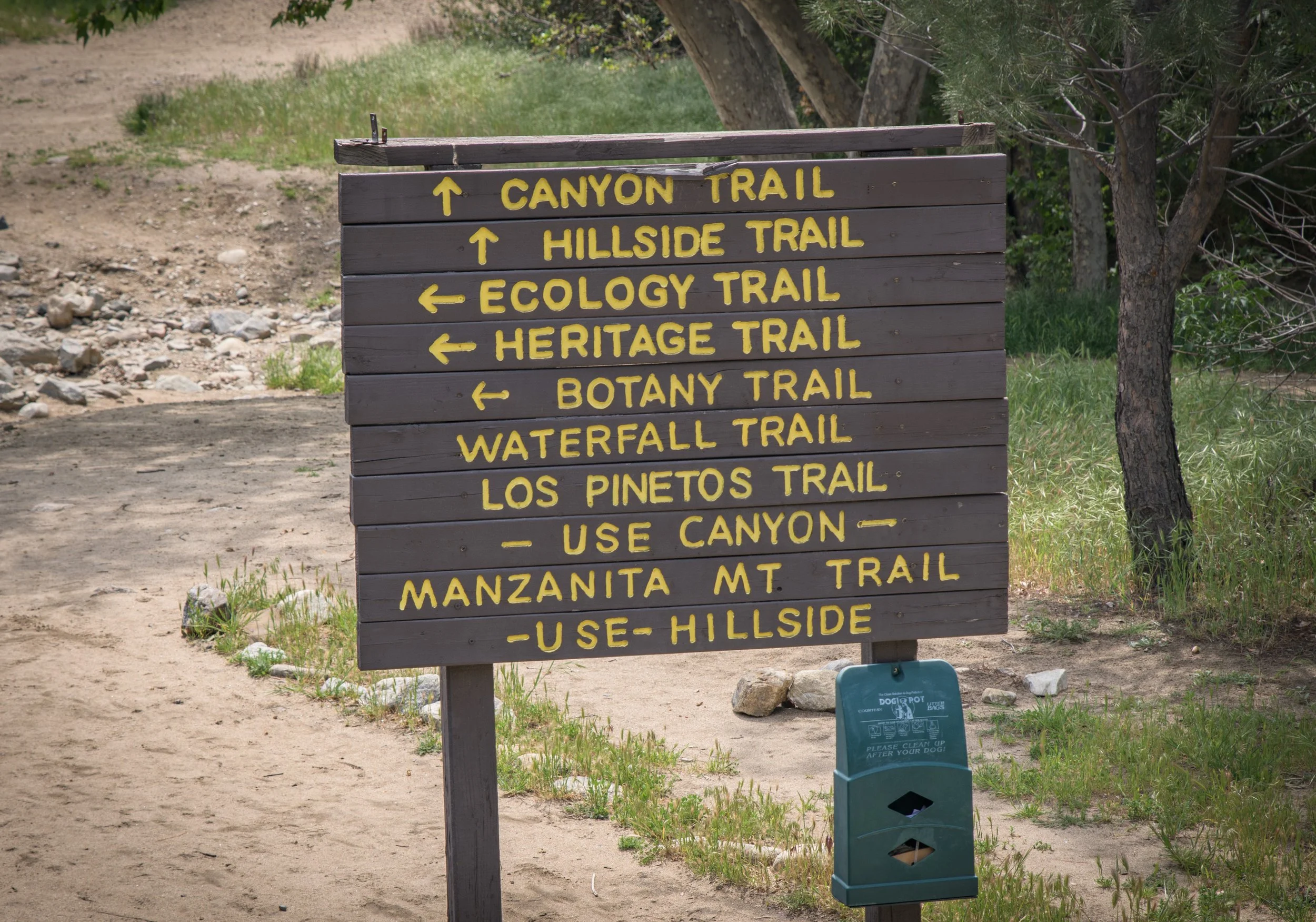
The amount of trails at Placerita can send your head spinning. For simplicity’s sake we are going to focus on the CANYON TRAIL, which is the most popular trail. If you’re curious about the other trails be sure to check out the complete list of trail descriptions on the official Placerita website.
Note: If you’re looking for a short, kid-friendly loop trail, the “Ecology Trail” behind the Nature Center is your best bet.
The main trail is called the “Canyon Trail”. The entire loop is a long one - roughly 5.4 miles, for the average adult it can be completed in 3-4 hours depending on if you’re walking fast, or taking breaks . If you’re hiking with young children, the entire loop will likely be too long (5 to 6 hours+), but you can still have a great time and see lots of things by hiking just a section of the trail - see the “Logistics” section below for hiking options for little ones.
The loop can be done clockwise or counterclockwise, for this write-up we’ll be doing the trail counter-clockwise, which just means going “straight” along the paved road upon arrival. If you’d like to travel the loop the opposite way, you’ll make a “left”after a couple minutes of walking from the main lot (at the green gate).
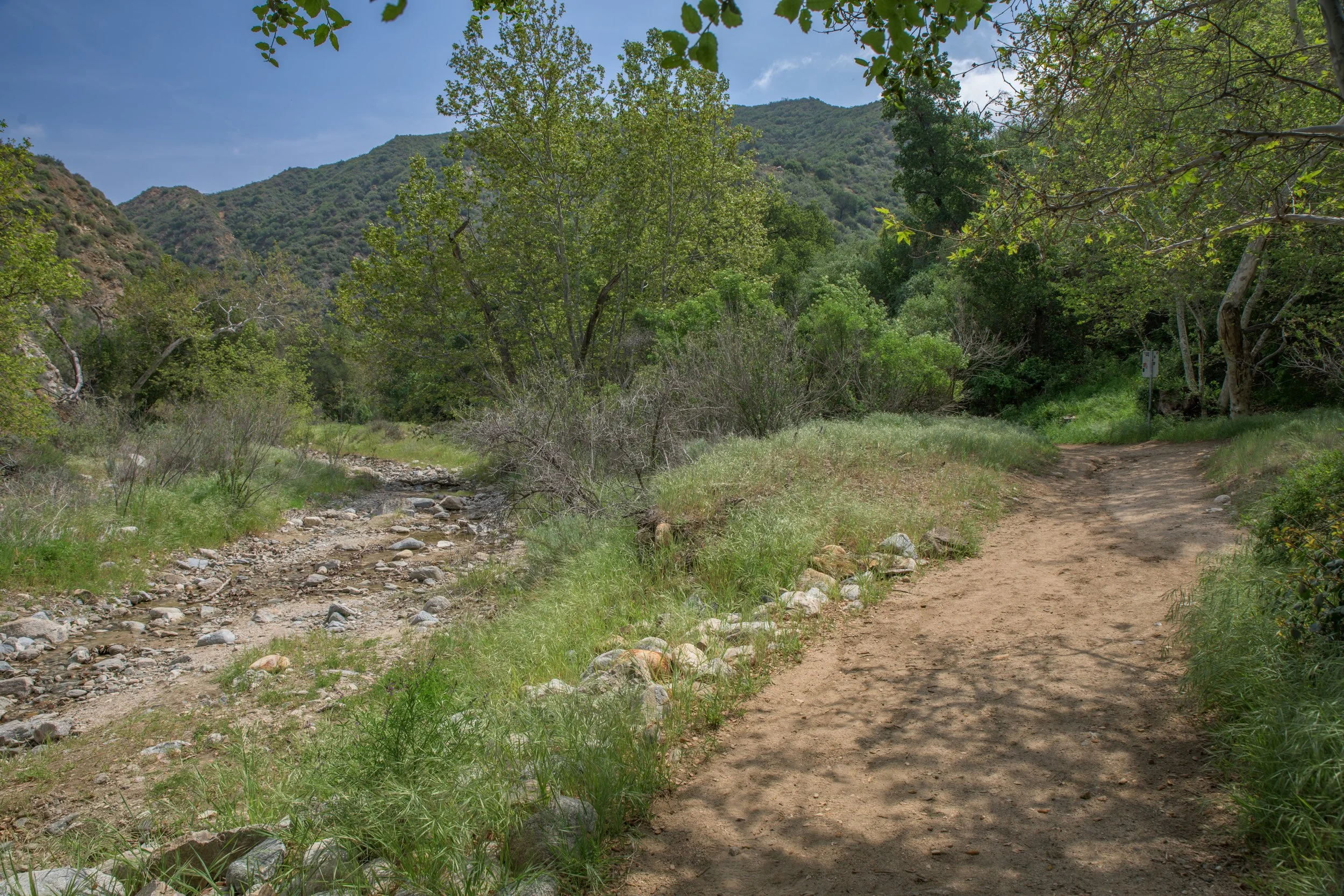
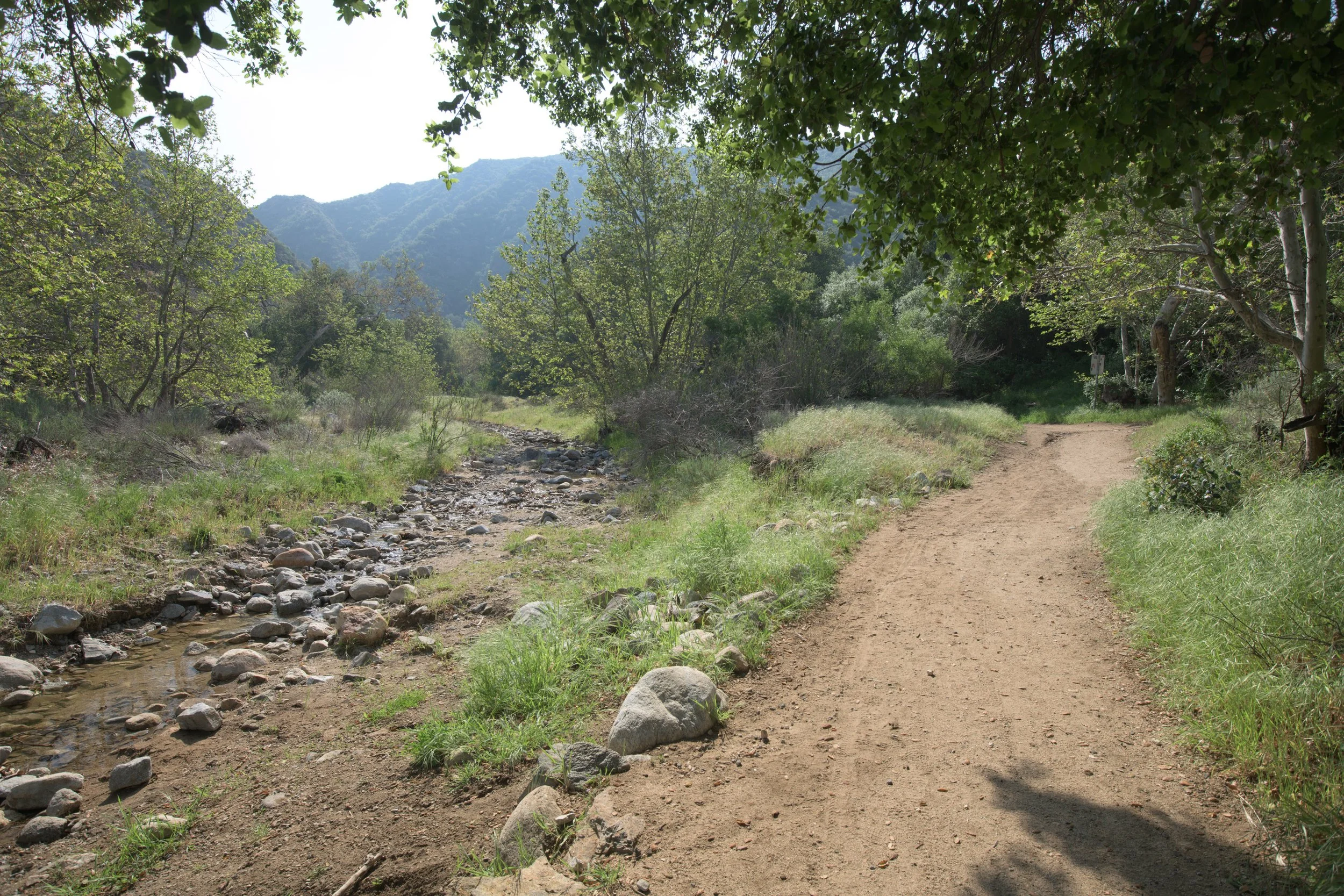
The first section of the trail (Section A) is paved and flat, which makes it great for strollers, young children, and anyone with mobility issues. If you’re just looking for a quick & easy 20-minute nature walk without getting your shoes dirty this is a great spot to do it. The area is scenic and wide open - with Santa Clarita’s iconic rolling hills and native plants. During winter/early spring, there is also a creek that runs along the trail. There’s also lots of other smaller trails that branch out into the hills from the main trail, so you can come back to this area again and again, and still discover new things to see.
Logistics
For navigation, simply type “Towsley Canyon Park” into your GPS or the official address is:
“24335 The Old Rd, Newhall, CA 91321”
Pull into the front gate at the entrance, the main parking lot will be on the right side across from the patch of trees. Parking is plentiful.
Parking Cost: Parking is free in the main lot. If you wish to skip the paved road (section A), there is a small pay-to-park lot ($7) at the end of the paved road which is rarely used.
Hours: Sunrise to Sunset
Is the trail stroller-friendly? A large section is, yes (see Section A below, which is paved)
Is the trail horse-friendly? Yes!
Notes to those with young children: The entire loop will be too long of a hike for most children. If you’re looking for 1-2 hours of hiking with your kids, I would recommend the following:
Sections A/B/C - If you’re looking for an easy, short walk that’s an hour or less, you can do walk Section A only (the paved road), explore the picnic area across the bridge, then turn around.
If you’d like to do a hike closer to 1.5-2 hours, continue on to Section B with the dirt trail to experience more hills, trees, and scenery and turn around whenever feels appropriate.
If you’re adventurous and feeling up-to-the challenge, you may be able to make it to “the Narrows” (section C) before turning around, but it will likely be 2.5-3 hours roundtrip with young kids. Another way to accomplish this faster, would be to skip Section A, by paying to park at the small lot at the end of the paved road.
Section G - By taking the left path shortly after you leave the main parking lot, you can get to the the dirt trail faster. This path also has more forest and shade, which makes it preferable in the summer. You can easily spend 1-2 hours exploring this peaceful section of the loop. If you’re feeling adventurous, you can aim to hit the tar pit at the end of the section (see the red circle on the diagram below) and then turn around which will likely be 2-2.5 hours roundtrip with young kids.
Canyon View Loop (short loop) - If you want to combine Sections A & G, you can do the optional “Canyon View Loop” which is 2.1 miles (see the pink dashed line below). If you start at Section A, you’ll cross the bridge at the picnic area, but stay to the left where you’ll see the trail. If you start at Section G, you’ll take a right up the hill where the trail splits (where the large, conspicuous stone is). Note, the pink dashed-lined section of this loop, goes up-and-over the hills, so prepare for some elevation again, it will likely take 2-3 hours to do this loop with young kids.
Checkout the diagram below for an overview of the park
(Note: The “sections” below signify different areas of the trail based off my own assessment and are not official in any way)
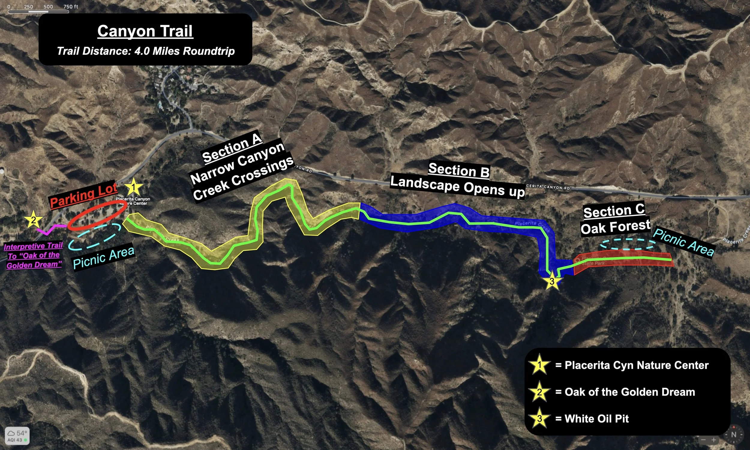
Trail Notes:
Near the end of Section F, after coming down from the hill, the trail splits. You’ll want to stay to the left.
Additional info can also be found at the Ed Davis Park in Towsley Canyon Page of the MRCA Website. You can download a PDF of the official trail map, learn more info/history about the trail, as well as view some additional photos of the park.
hike BONUS

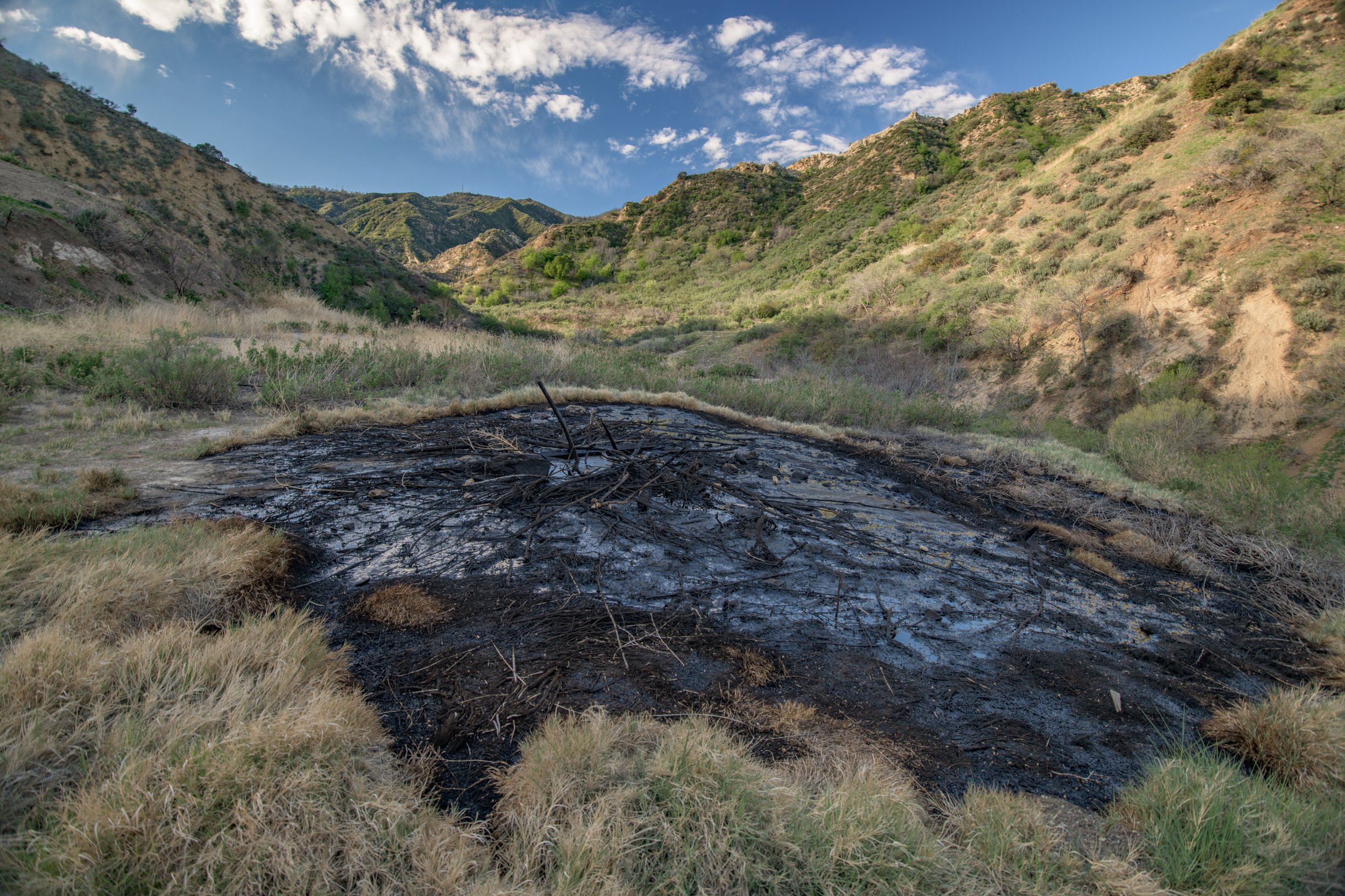
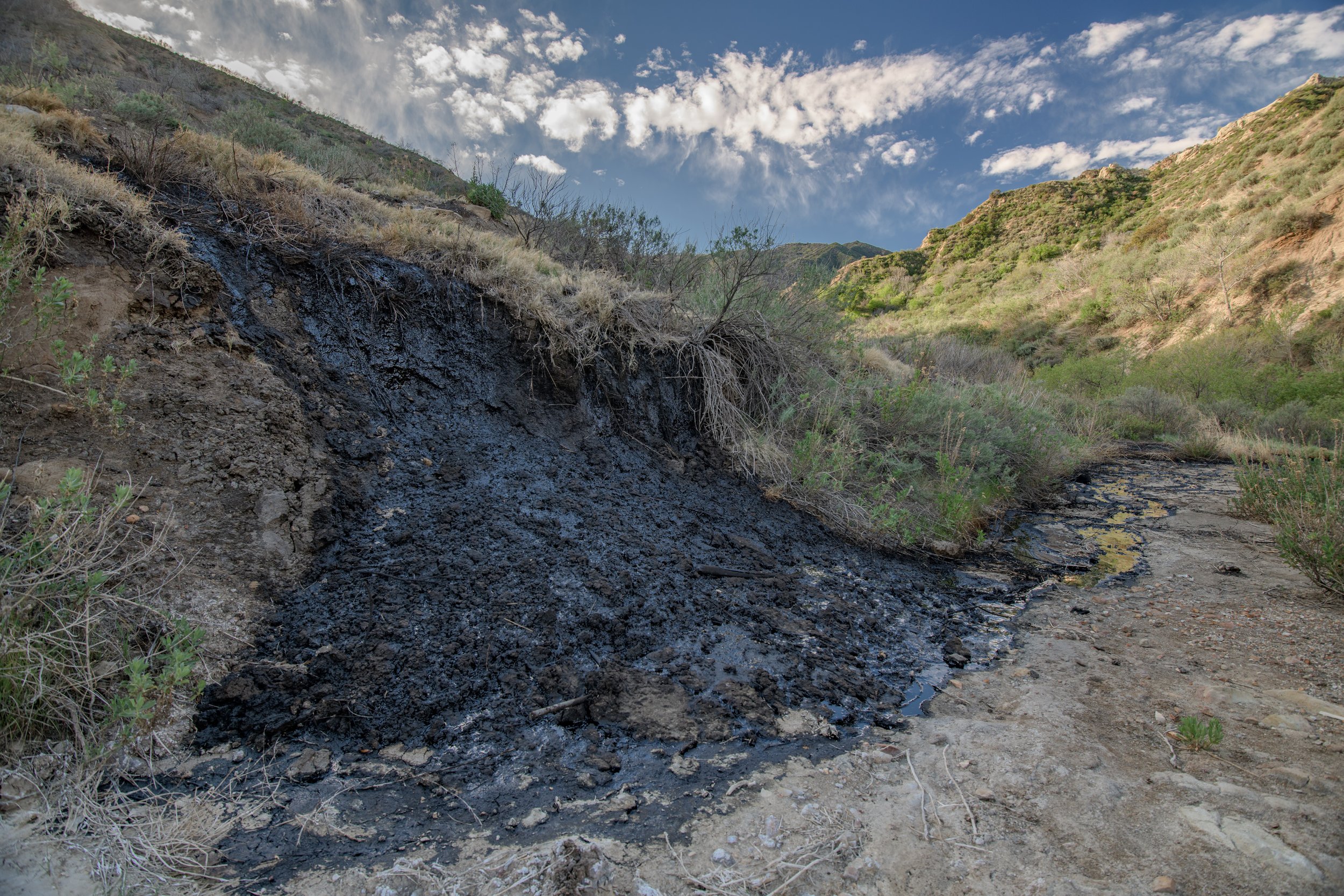
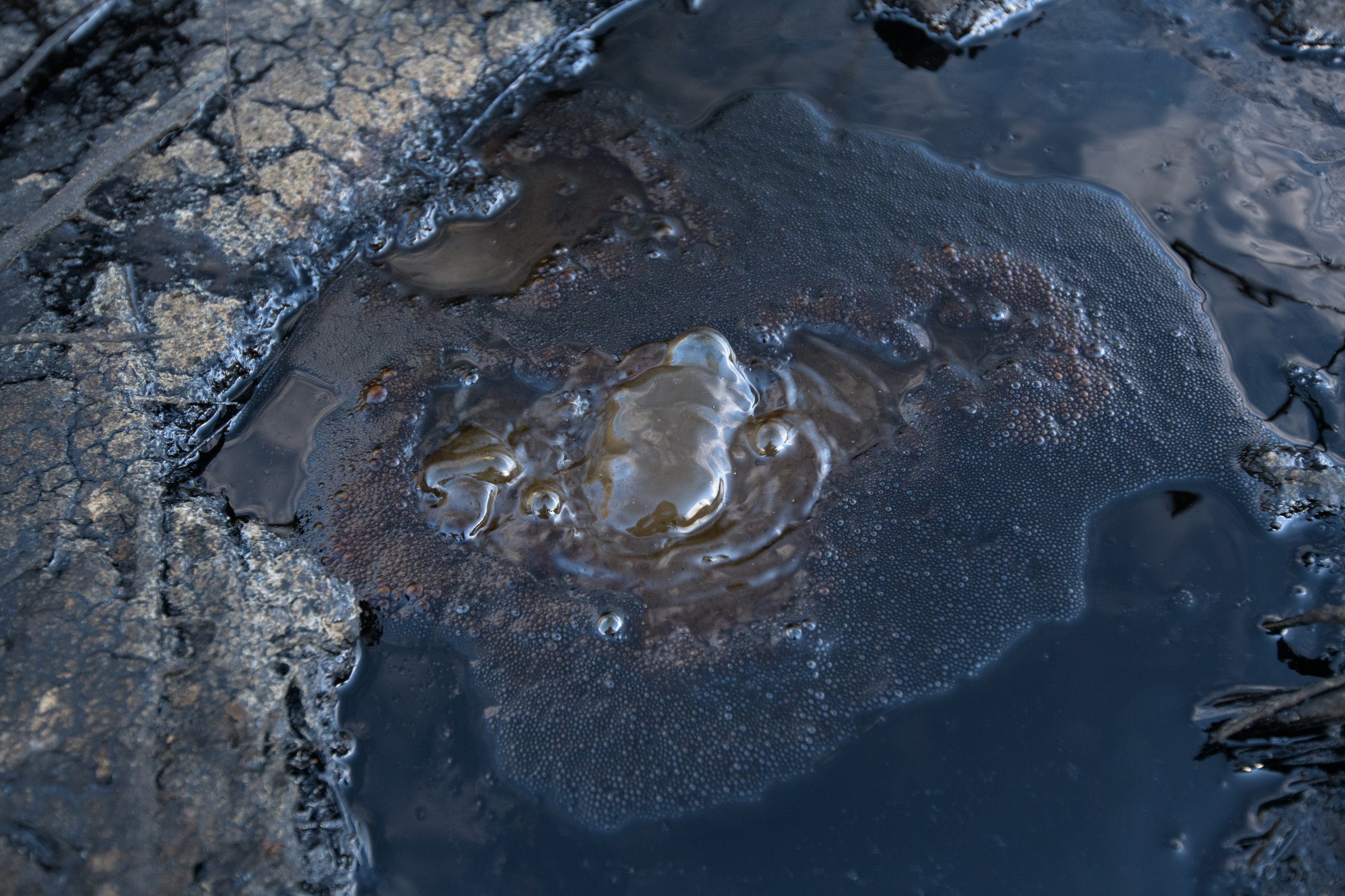
Natural Tar, Bubbling Up from the Earth!
Towsley Canyon is the best place in Santa Clarita to view these bubbling tar/asphalt pits. There are two small tar pits on the trail itself, and one larger area (my favorite) that is just below the main trail, see the above diagram for their locations.
Tar pits are natural pools of asphalt that form in the presence of oil, which is created when organic matter is subject to pressure underground. Fractures in the rock layers below allow for this black, sticky tar to rise up to the surface.
The presence of oil here is exactly why there is a long history of oil drilling in Towsley Canyon.
Many people have left sticks in the tar pits, please refrain from doing this, as it detracts from the beauty of this natural phenomenon.