Towsley canyon
Introduction
Ed Davis Park in Towsley Canyon is one of Santa Clarita’s most popular hiking destinations. It’s easily accessible off the 5 freeway, a large portion of the trail is flat, and there is plenty to see including - a green picnic area with a stream (great for kids), a slot-like canyon with interesting rock formations, and multiple bubbling tar pits. Read below to see why this is a local favorite.
trail
The main trail is called the “Towsley View Loop Trail” (also known as the “Don Mulally Trail”). The entire loop is a long one - roughly 5.4 miles, for the average adult it can be completed in 3-4 hours depending on if you’re walking fast, or taking breaks . If you’re hiking with young children, the entire loop will likely be too long (5 to 6 hours+), but you can still have a great time and see lots of things by hiking just a section of the trail - see the “Logistics” section below for hiking options for little ones.
The loop can be done clockwise or counterclockwise, for this write-up we’ll be doing the trail counter-clockwise, which just means going “straight” along the paved road upon arrival. If you’d like to travel the loop the opposite way, you’ll make a “left”after a couple minutes of walking from the main lot (at the green gate).
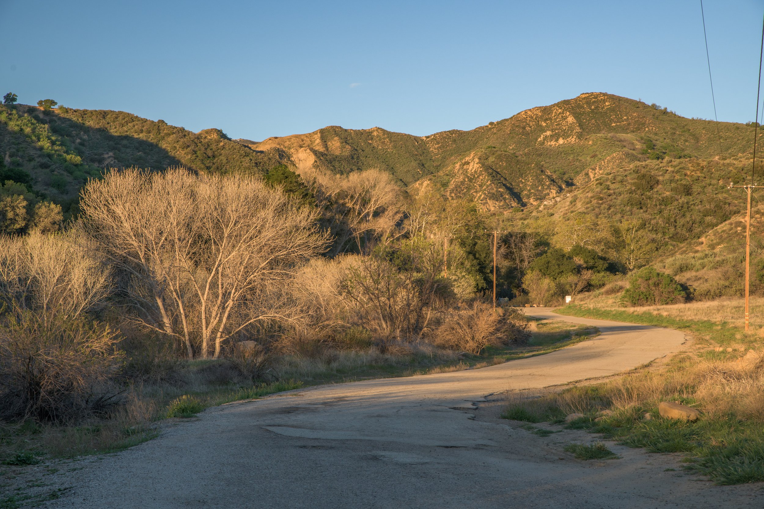
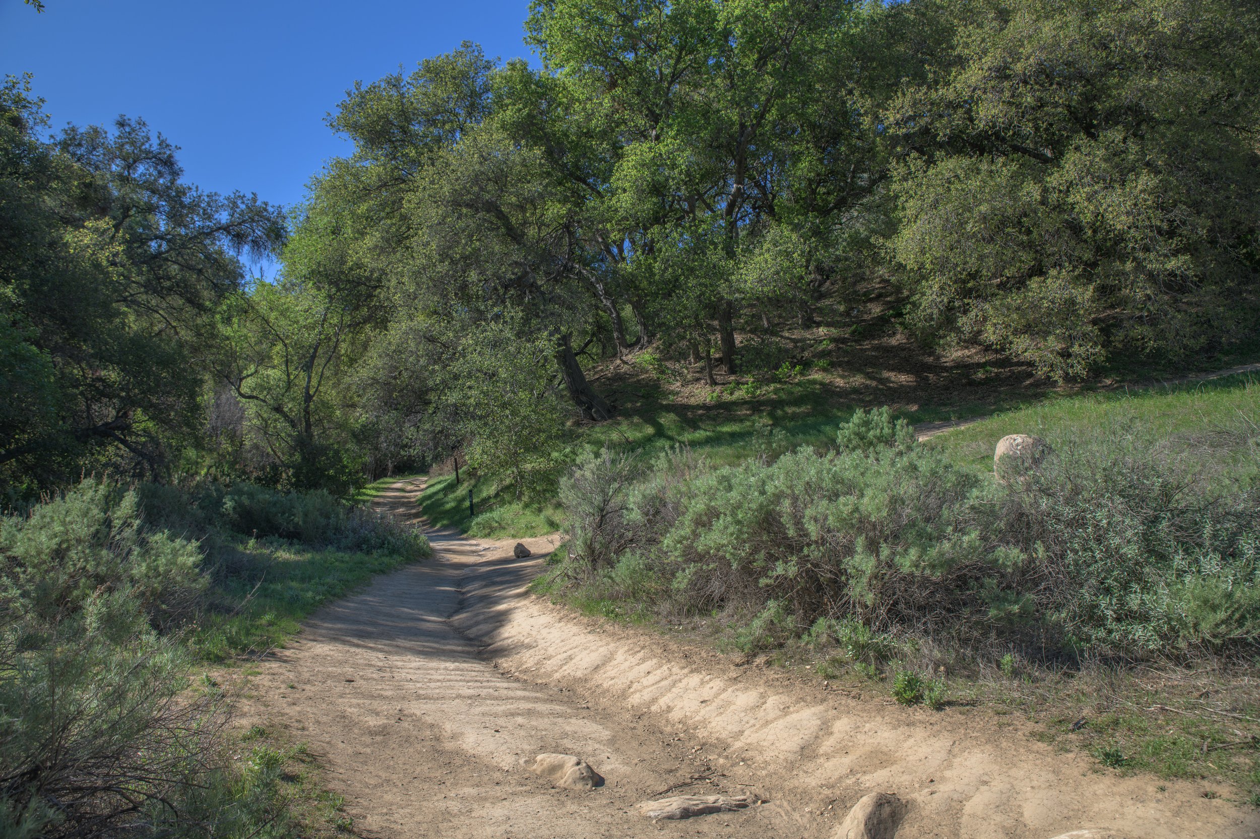
The first section of the trail (Section A) is paved and flat, which makes it great for strollers, young children, and anyone with mobility issues. If you’re just looking for a quick & easy 20-minute nature walk without getting your shoes dirty this is a great spot to do it. The area is scenic and wide open - with Santa Clarita’s iconic rolling hills and native plants. During winter/early spring, there is also a creek that runs along the trail. There’s also lots of other smaller trails that branch out into the hills from the main trail, so you can come back to this area again and again, and still discover new things to see.
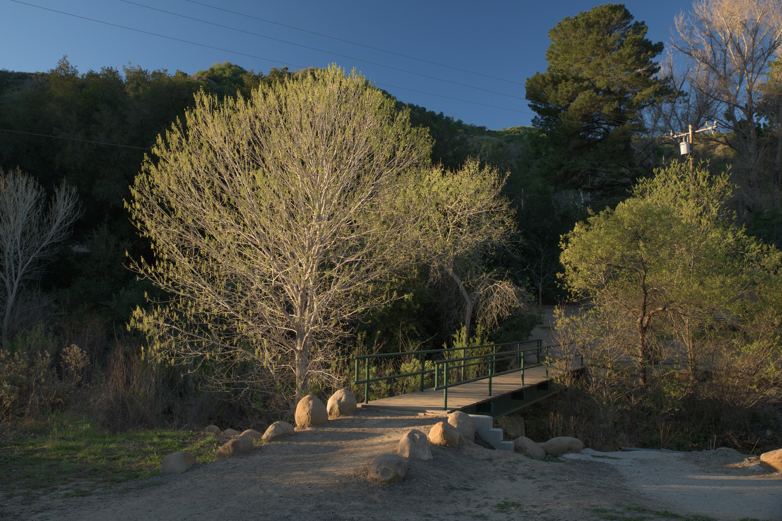
At the end of the paved road there’ll be a small bridge on the left that crosses the creek. On the other side of the bridge is a picnic area spread across some green grass, and tall trees. It’s a great place to take a break, or have a picnic. We’ve even seen a group of deer grazing here. On top of the hill is a building called the “Towsley Lodge” which can be rented out for events (click here to read more about the history of Towsley Lodge).
If you were only looking for a quick nature walk, this is a natural spot to end at before turning around, otherwise the trail is just beginning! To continue on, come back across the bridge, back to the main trail which will now turn to dirt.

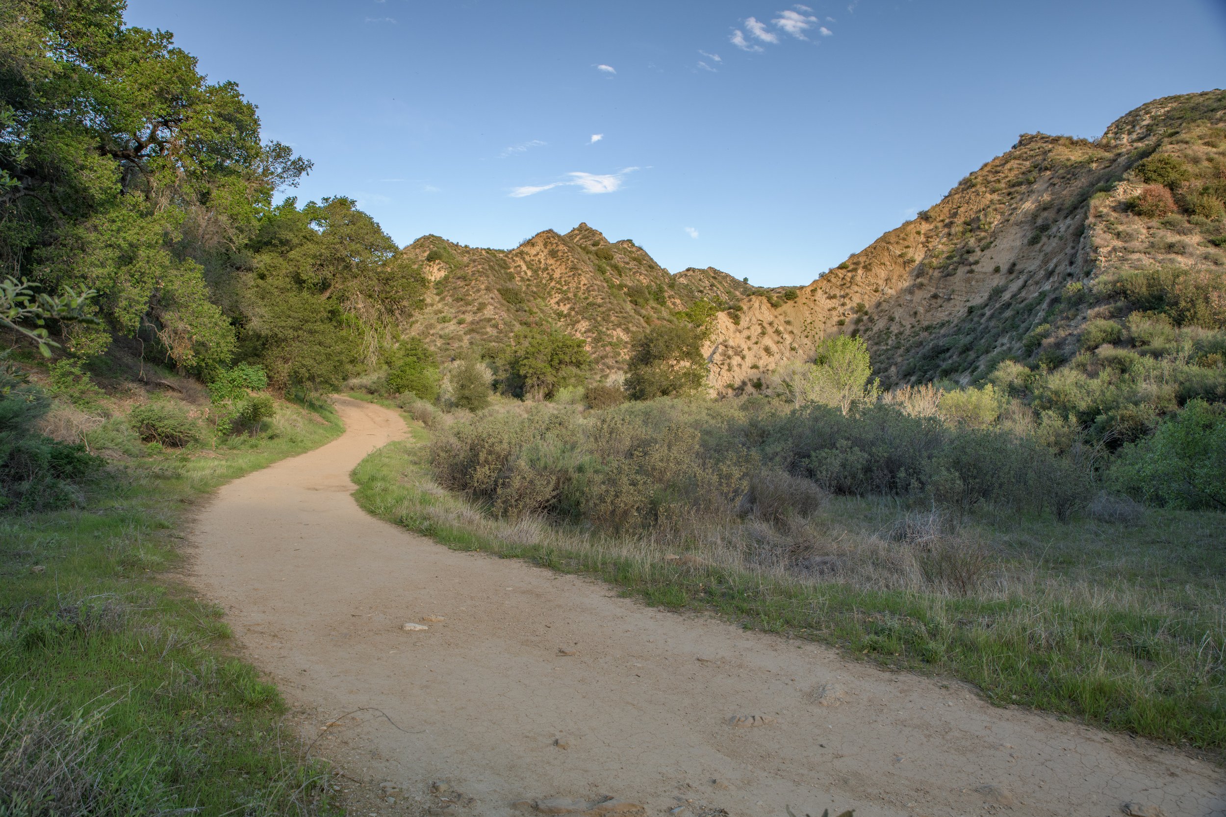
For the next leg (Section B), the dirt trail will continue along the creek. The trail begins to wind through the hills and the plants, there is some gentle elevation gain here and there, but it is still mostly flat.
As you walk this section, it will feel more and more like you’re leaving civilization behind. The sound of the freeway traffic will disappear and the scenery will gradually fill with bright green oak trees, larger hills and cliffs with interesting geologic formations.
Eventually the cliffs will close-in, and you will enter “The Narrows” - a slot-like canyon (Section C), a highlight of this hike.
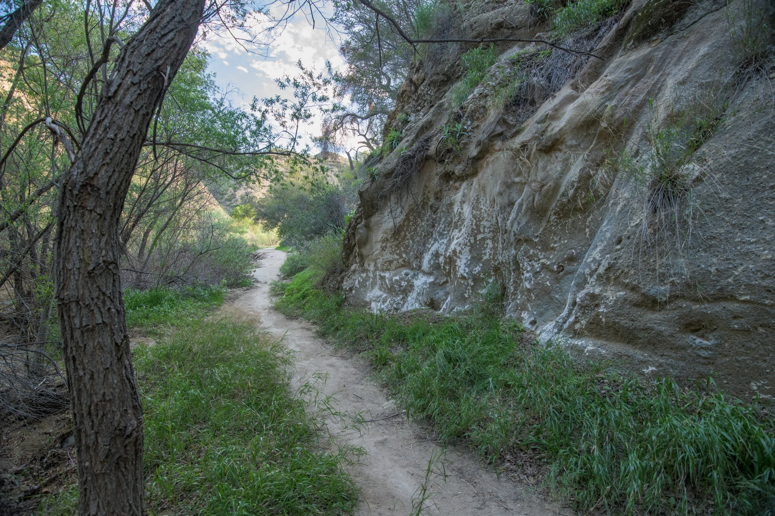
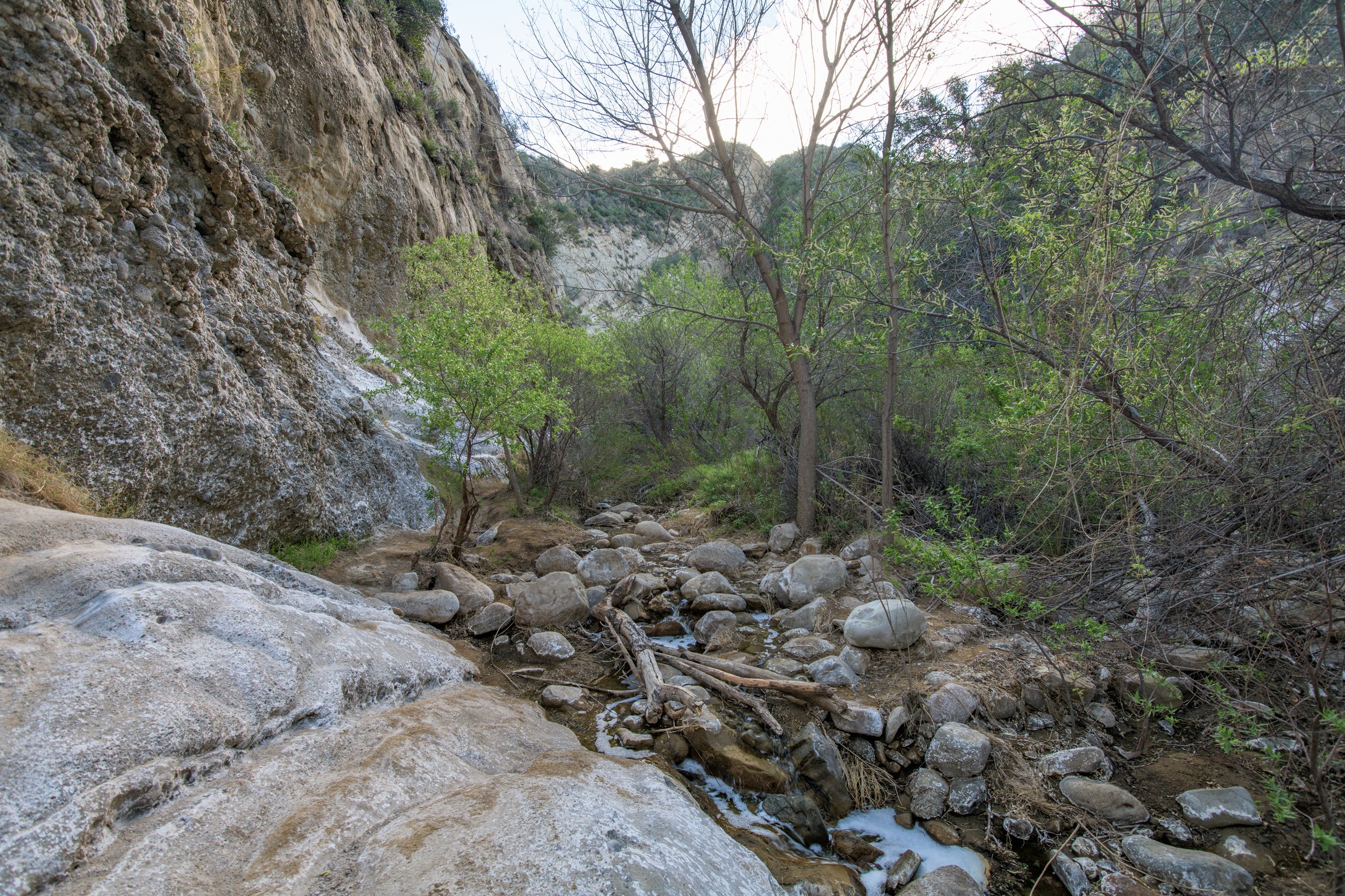
Towsley Creek runs through the center of The Narrows, while the trail appears to cross the creek several times, you can easily hike on either side . Take some time to soak in the incredible rocks and views of this unique place. This section of the hike is relatively short, you’ll likely be out of the canyon after five minutes if you don’t stop.

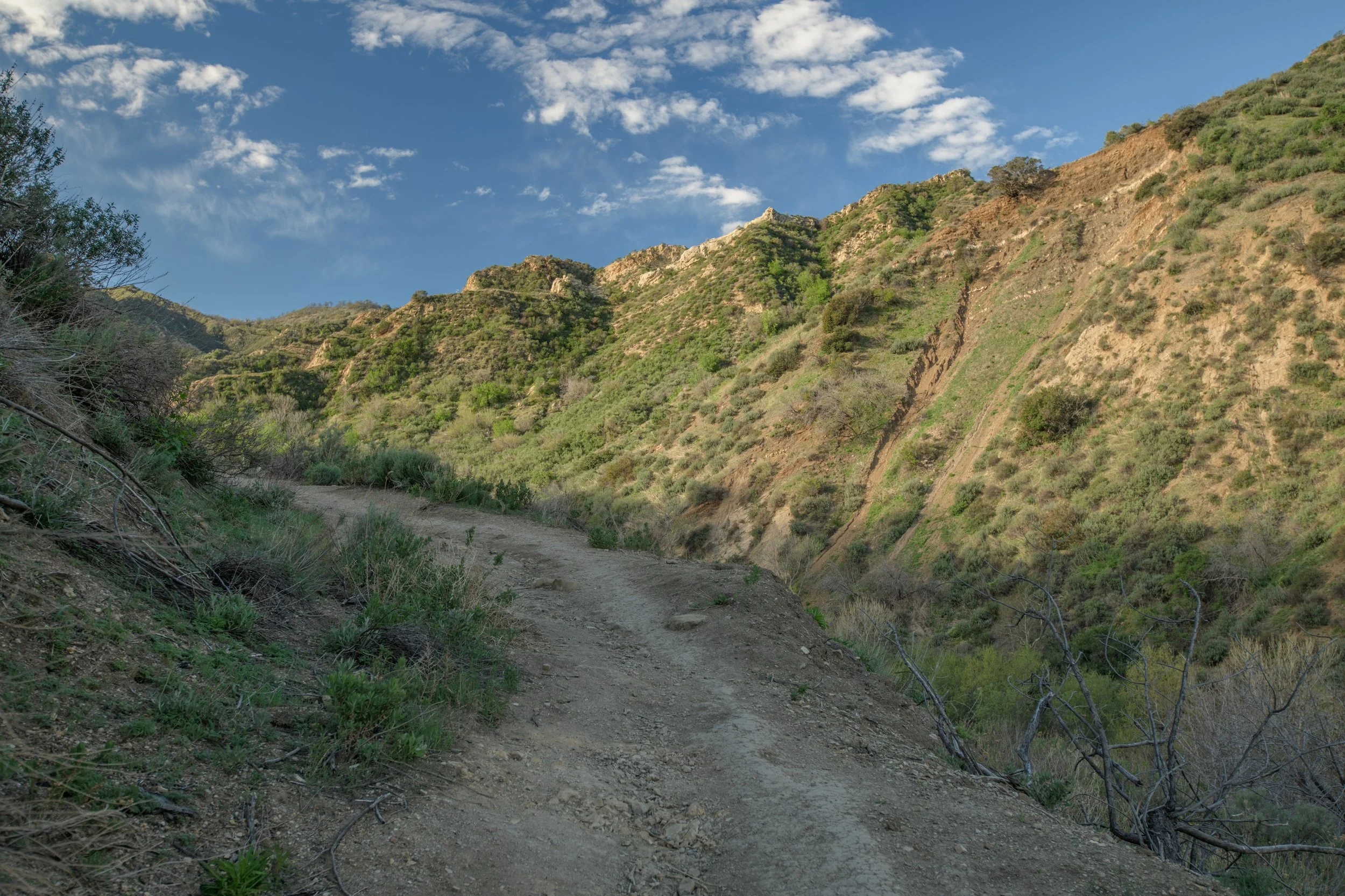
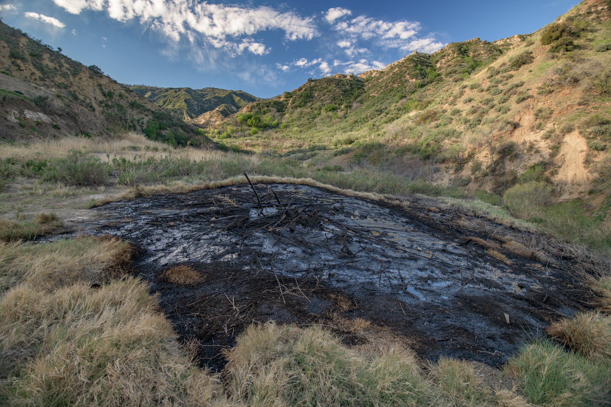
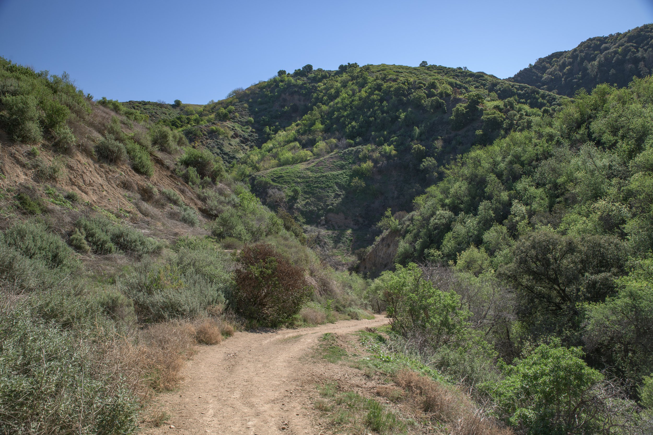
After emerging from the canyon, you’ll start the slow ascent through a valley that feels even more remote (Section D). Given the distance, many people don’t make it this far back on the trail. This section is the most quiet and peaceful, and the expanse of the valley is awe inspiring.
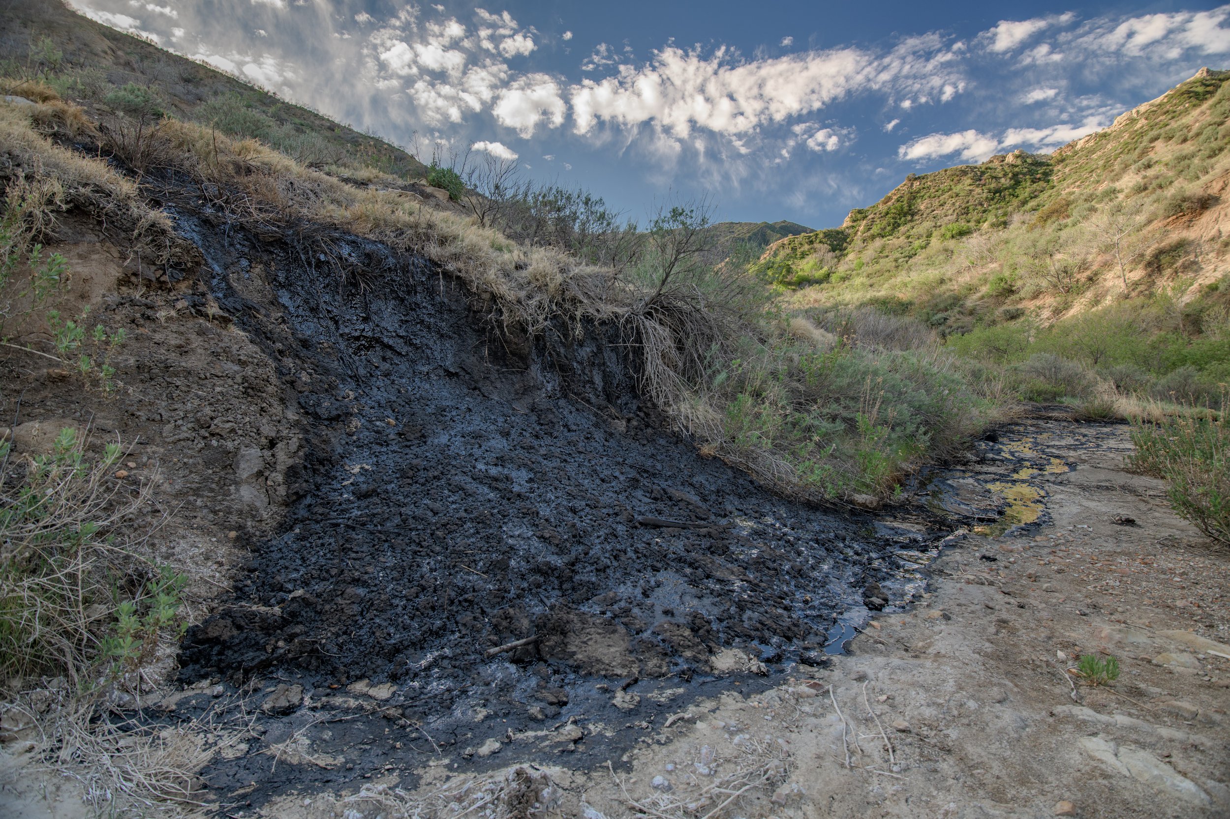
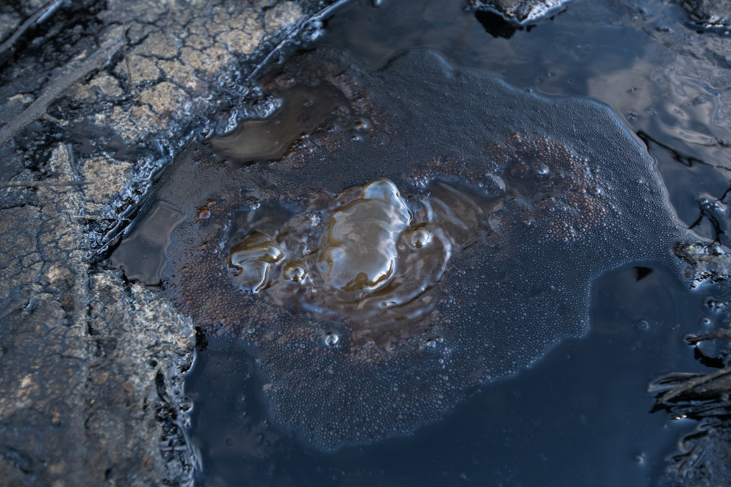
As you hike up, you may spot a dark “pond-like” thing just below the main trail (see picture above). This is actually a natural tar pit or asphalt pit. There are several others along the trail, but this one is the biggest, and least disturbed. If you look closely, you can actually find the tar actively “bubbling” to the surface. Read more about the tar pits on the bottom of the page.
After passing the tar pit. The switchbacks begin, this is the most difficult part of the hike, you’re guaranteed to break a sweat, as you hike up, and up, and up.

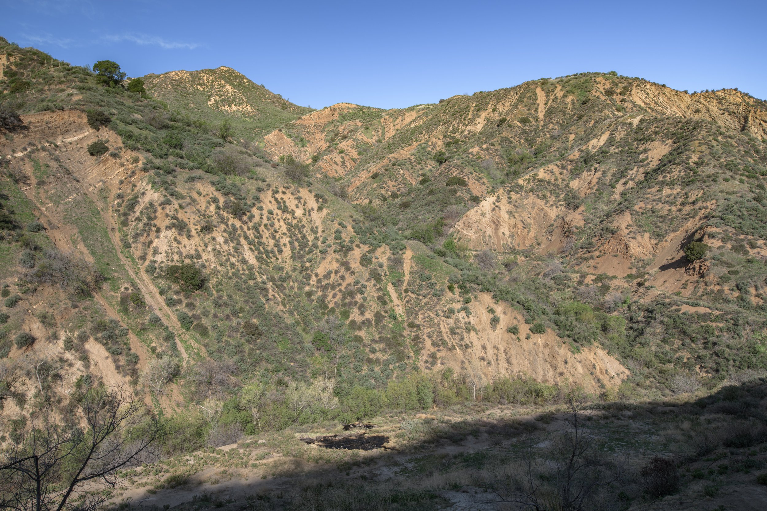
Once you’ve made it to the top section (Section E), you’ll be greeted by some gorgeous views over the Santa Clarita Valley. It’s a great place to catch your breath before continuing on. You’ll have a little higher to go, before reaching the top-top.
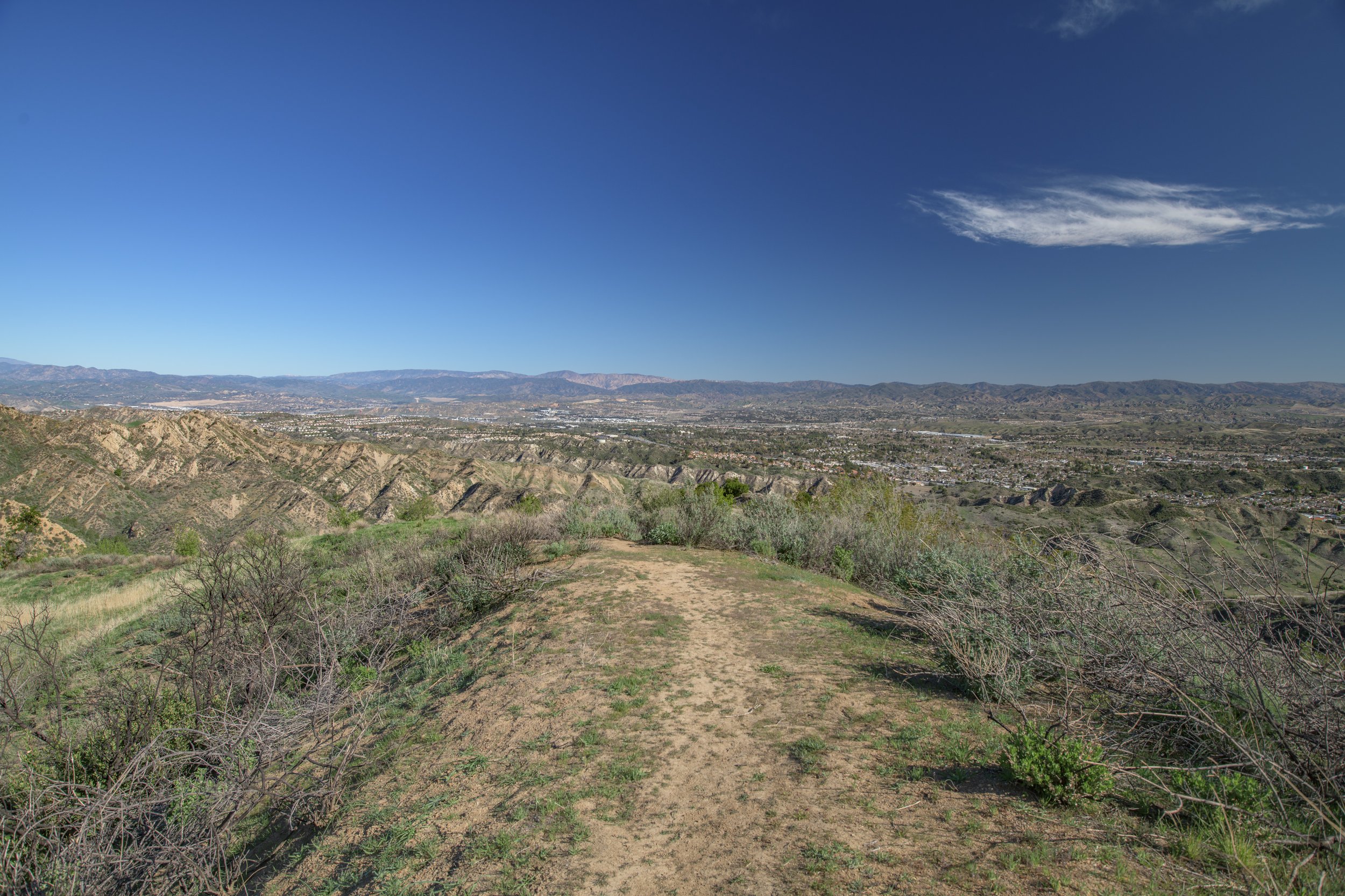
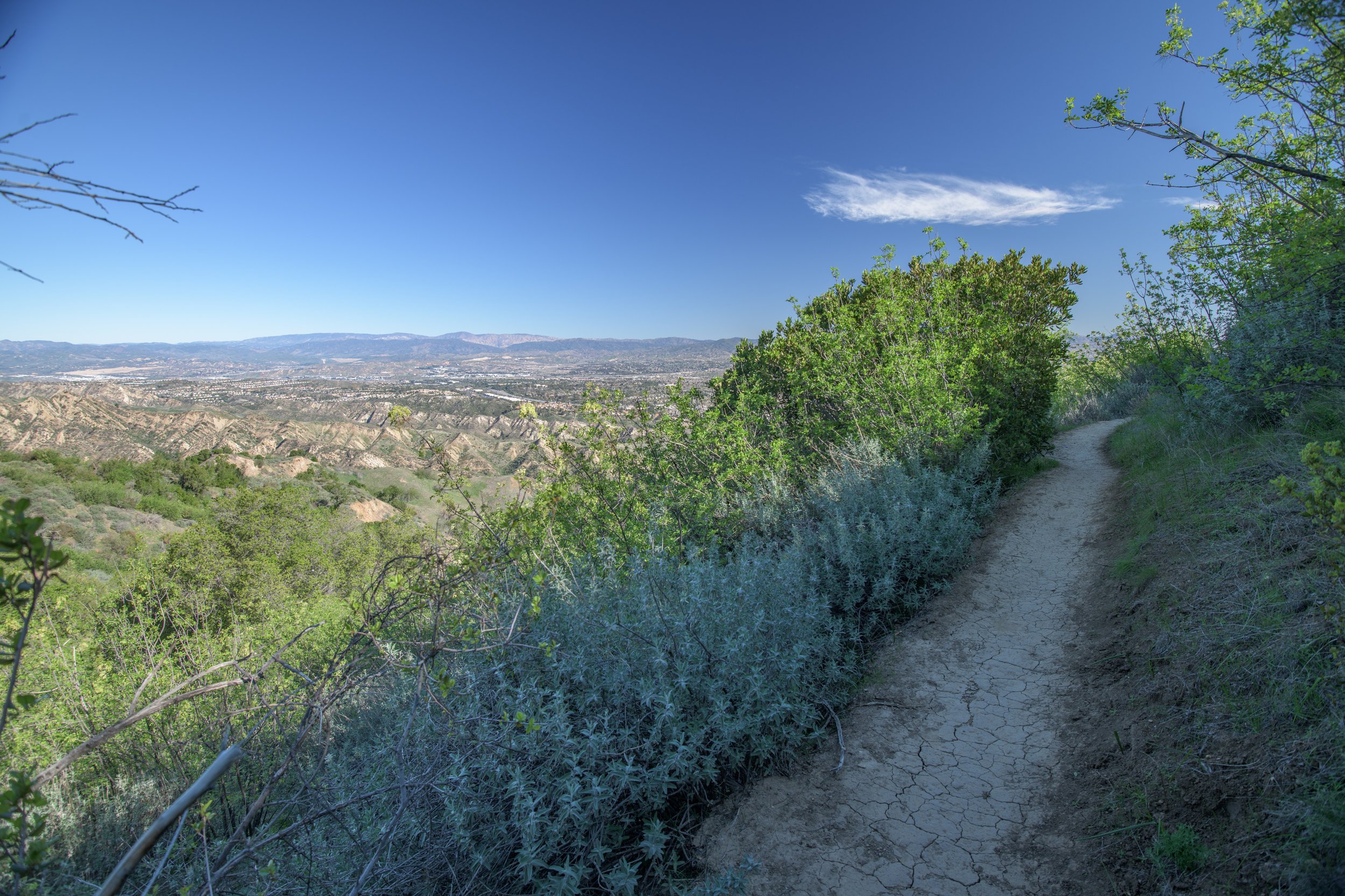

The above picture with the trees is one of my favorite areas from the top section of the hike. There are a few gorgeous oak trees and nearly 360 views at the top of the ridge. If you’ve brought a sack lunch, this is a great place to unroll a picnic blanket and eat. Otherwise, looking below you’ll spot where the 5 freeway ascends into the hills towards the San Fernando Valley, and even the lower sections of the trail that you’ll soon be walking on.


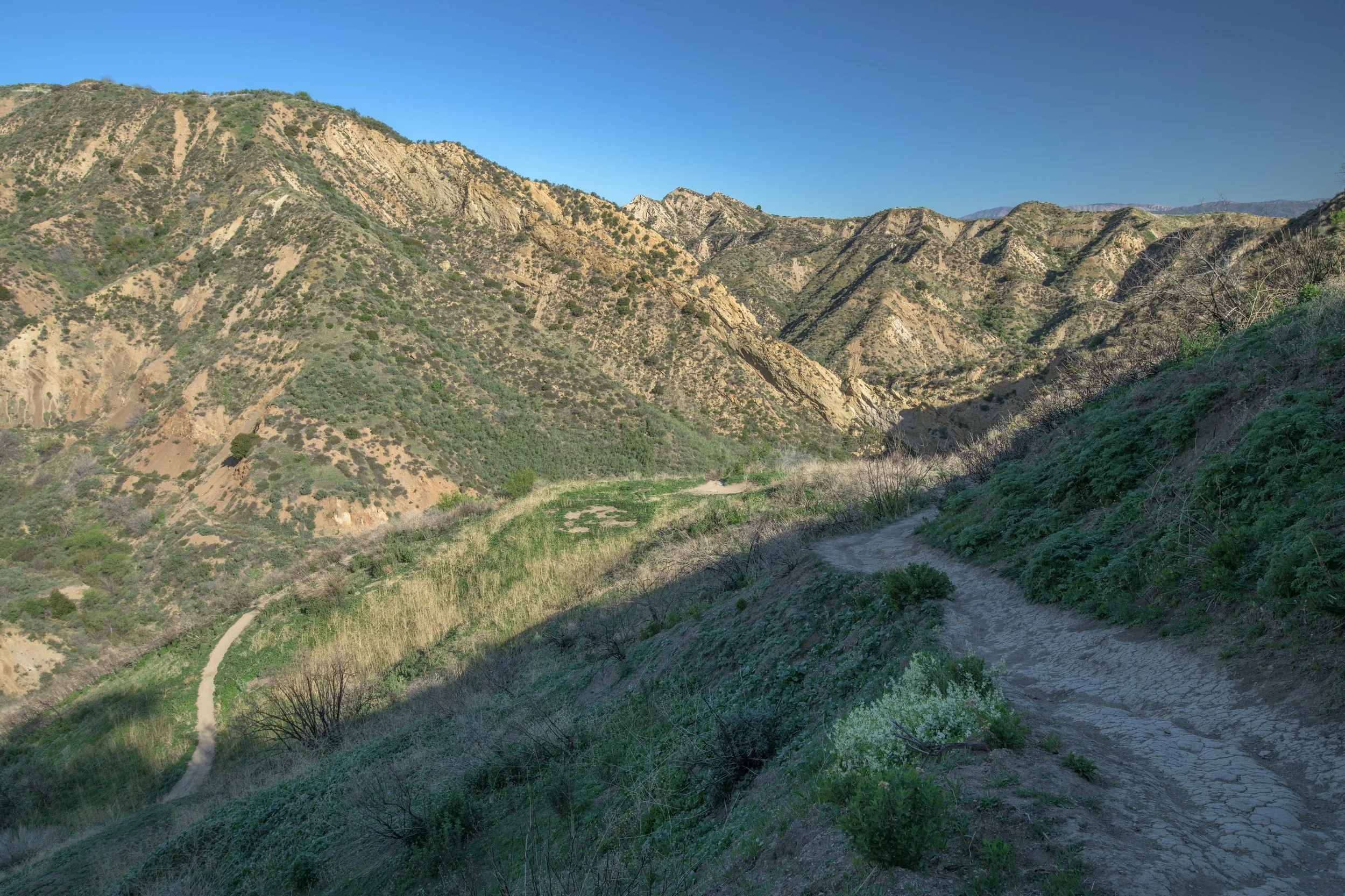
Then begins the descent (Section F) before the last leg of the loop. The trail here gets a little steep, but thankfully it’s all downhill from here.
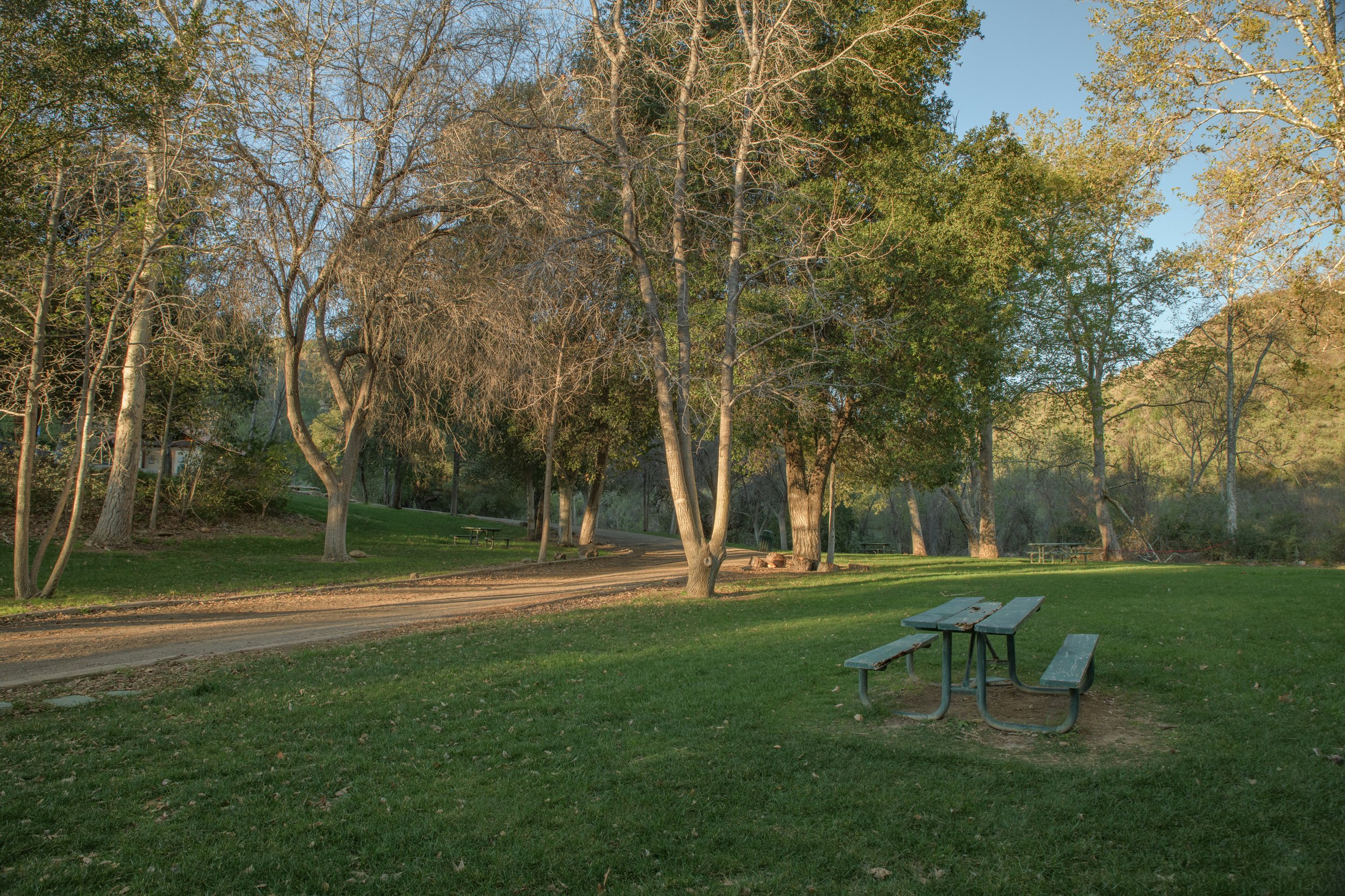
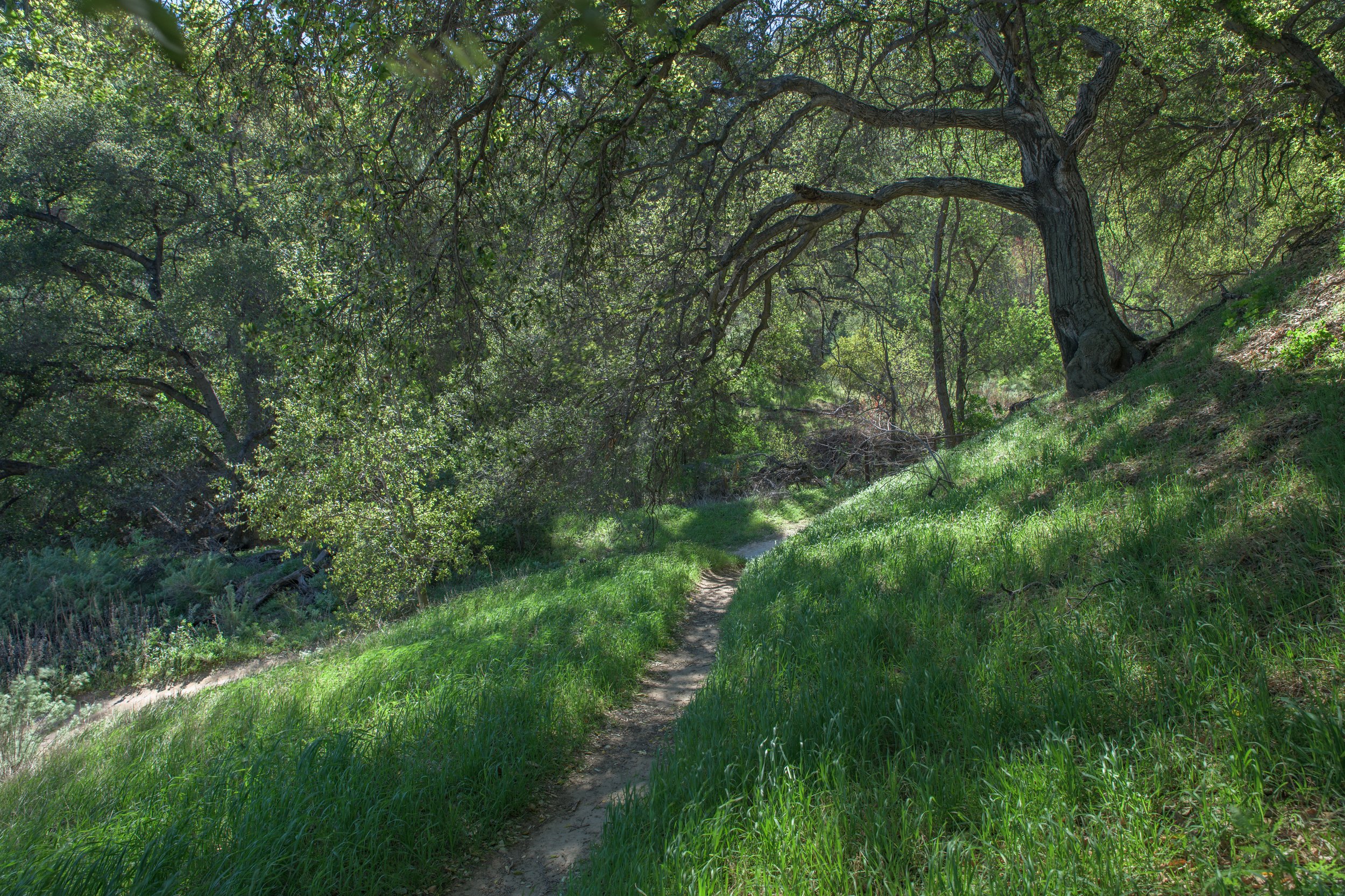
The last leg of the loop (Section G) is very scenic and less open than the rest of the trail. This section is the most green, has the most forest, and most shade of the whole loop. It starts off with another tar pit, and continues along the creek.
As you head out of the forest, and the landscape opens up, you’ll recognize the familiar hills from the start of the loop. Congratulations, you’ve made it to the end!

Logistics
For navigation, simply type “Towsley Canyon Park” into your GPS or the official address is:
“24335 The Old Rd, Newhall, CA 91321”
Pull into the front gate at the entrance, the main parking lot will be on the right side across from the patch of trees. Parking is plentiful.
Parking Cost: Parking is free in the main lot. If you wish to skip the paved road (section A), there is a small pay-to-park lot ($7) at the end of the paved road which is rarely used.
Hours: Sunrise to Sunset
Is the trail stroller-friendly? A large section is, yes (see Section A below, which is paved)
Is the trail horse-friendly? Yes!
Notes to those with young children: The entire loop will be too long of a hike for most children. If you’re looking for 1-2 hours of hiking with your kids, I would recommend the following:
Sections A/B/C - If you’re looking for an easy, short walk that’s an hour or less, you can do walk Section A only (the paved road), explore the picnic area across the bridge, then turn around.
If you’d like to do a hike closer to 1.5-2 hours, continue on to Section B with the dirt trail to experience more hills, trees, and scenery and turn around whenever feels appropriate.
If you’re adventurous and feeling up-to-the challenge, you may be able to make it to “the Narrows” (section C) before turning around, but it will likely be 2.5-3 hours roundtrip with young kids. Another way to accomplish this faster, would be to skip Section A, by paying to park at the small lot at the end of the paved road.
Section G - By taking the left path shortly after you leave the main parking lot, you can get to the the dirt trail faster. This path also has more forest and shade, which makes it preferable in the summer. You can easily spend 1-2 hours exploring this peaceful section of the loop. If you’re feeling adventurous, you can aim to hit the tar pit at the end of the section (see the red circle on the diagram below) and then turn around which will likely be 2-2.5 hours roundtrip with young kids.
Canyon View Loop (short loop) - If you want to combine Sections A & G, you can do the optional “Canyon View Loop” which is 2.1 miles (see the pink dashed line below). If you start at Section A, you’ll cross the bridge at the picnic area, but stay to the left where you’ll see the trail. If you start at Section G, you’ll take a right up the hill where the trail splits (where the large, conspicuous stone is). Note, the pink dashed-lined section of this loop, goes up-and-over the hills, so prepare for some elevation again, it will likely take 2-3 hours to do this loop with young kids.
Checkout the diagram below for an overview of the park
(Note: The “sections” below signify different areas of the trail based off my own assessment and are not official in any way)

Trail Notes:
Near the end of Section F, after coming down from the hill, the trail splits. You’ll want to stay to the left.
Additional info can also be found at the Ed Davis Park in Towsley Canyon Page of the MRCA Website. You can download a PDF of the official trail map, learn more info/history about the trail, as well as view some additional photos of the park.
hike BONUS

Natural Tar, Bubbling Up from the Earth!
Towsley Canyon is the best place in Santa Clarita to view these bubbling tar/asphalt pits. There are two small tar pits on the trail itself, and one larger area (my favorite) that is just below the main trail, see the above diagram for their locations.
Tar pits are natural pools of asphalt that form in the presence of oil, which is created when organic matter is subject to pressure underground. Fractures in the rock layers below allow for this black, sticky tar to rise up to the surface.
The presence of oil here is exactly why there is a long history of oil drilling in Towsley Canyon.
Many people have left sticks in the tar pits, please refrain from doing this, as it detracts from the beauty of this natural phenomenon.